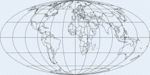
MAP PROJECTIONS
A map is not a simple drawing of the earth’s surface, but its model obtained on the basis of certain mathematical laws. First, we pass from the physical earth’s surface onto the mathematical surface – rotational ellipsoid or sphere. This transfer is realised by means of orthogonal projection of physical surface points onto the mathematical surface by using geodetic control network enabling correct geographic location and orientation of map contents within the frame of some co-ordinate network. Afterwards follows the transfer from the rotational ellipsoid surface or sphere into the plane. These projections are called map projections and are the subject of the theory of map projections.
Map projections have been developing parallel with the development of map production and cartography in general. The development of many sciences, technical achievements and the needs of everyday life have gradually initiated wider and wider demands for the production of various topographic and thematic maps in various scales and for various purposes, which requested continuous growth of map projections and improvement of mathematical basis of maps.
The various systems of map projection employed can be expressed as mathematical formulae. Every point on the earth’s surface has a unique location given by its geographical co-ordinates (latitude and longitude). A systematic map projection takes those geographical co-ordinates and translates them into Cartesian co-ordinates on the map by means of a mathematical formula. Before the advent of rapid computing power, projecting a map required a great deal of time to calculate, but computer programs are now readily available which allow even very complex map projections to be carried out rapidly.
In converting the 3-D earth to Cartesian co-ordinates, the fixed relationship between all points on the globe cannot be kept and distortions have to be introduced. A map projection may distort angles, areas or distances; any map projection cannot keep more than one of angle, area or distance correct.
Map projections fall into one of a number of groups, but there are four main groups of projections: equal area or equivalent (which keep areas correct), equal distance (or equidistant, which preserve distances in a particular direction, e. g. along the meridians), equal angle (also called conformal which keep angles correct), and hybrid or miscellaneous (where angles, distances nor areas are correct, but area and angle distortions can be somehow acceptable).