Mathematical data for bibliographic descriptions of cartographic materials and spatial data
Jan Smits, Koninklijke Bibliotheek
Original release: 1996
Last update: February
15, 2013
Recovered by Joel Kovalsky, October 23, 2015
Diacritical signs recovered by Miljenko Lapaine, November 2, 2015
Online again by Dražen Tutić, November 2, 2015
- Bar scale values
- Petermann's bar scale values
- Mile
- Geoff Armitage's Conversion table of measurements
- Publications concerning bar scale values and other measures
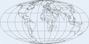
Map projections
Map projection is "the process of systematically transforming positions on
the Earth's spherical surface to a flat map while maintaining spatial
relationships. This process is accomplished by the use of geometry or, more
commonly, by mathematical formulas. Map projection can be best visualized by
imagining a light bulb placed at the centre of a transparent globe and having
its lines of longitude and latitude cast upon either a flat sheet of paper or a
sheet of paper rolled into a cylinder or cone placed over the globe." (from Atlas of Canada: map projection).
A good text for beginners to consult the
text concerning scale and map projection from Arthur H. Robinson's et
al. book Elements of cartography (6th ed., New York, 1995).
For a more sophisticated approach one can use the unit on ,
which is part of Brian Klinkenberg's GIS and Cartography Online
Resources with the University of
California at Santa
Barbara.
For those converting analogue to digital the following publications are available:
Map projections used by the U.S. Geological Survey / by John P. Snyder. - 2nd ed. - Washington : United States Government Printing Office, 1984. - 313 p. : ill. ; 23 cm + map. - (Geological Survey bulletin ; 1532)
A more recent online edition of this publication with a
zipped file which contains the entire text of USGS
Bulletin 1856, Bibliography of Map Projections, edited by John
P. Snyder with Harry Steward and published in 1988. John Snyder has since
corrected, supplemented, and renumbered the text in 1994 and 1996. It is also
converted from a coded file, which can be printed with all the diacritical
marks in the various languages on an Epson printer using a homemade word
processor, to HTML codes to permit reading of all diacriticals allowed on the
Internet. The exceptions are diacriticals used only in Eastern European
languages, which are removed and the letter shown without a diacritical, except
that the Hungarian double accent acute is made an umlaut. He also has the
Bibliography in a Microsoft Word file, so that all Eastern- and Western-European
diacriticals, as well as new insertions of Russian Cyrillic following the
transliterations already included, may be displayed in the printed form or on
the screen.
The USGS upkeeps the site Map
projections, which contains a description and visualisation of 17 main
projections, a summary of projection properties, and a summary of areas
suitable of mapping with projections.
Some of these projections are also illustrated on Zbigniew
Zwolinski's 'The Great Globe Gallery'.
The most recent publication in this field is:
Map projection transformation : principles and applications / Qihe
Yang, John P. Snyder, Waldo R. Tobler. - London :
Taylor & Francis, 2000. - xv, 367 p. : ill. ; 21
cm. - ISBN 0-7484-0667-0 (Hard cover); ISBN 0-7484-0668-9 (pbk.).
A more sophisticated site with actual mapprojection and their algebraic formulae can be found on the Map projection-page of Wolfram Research.
Somewhat older, simpler and less extensive publications are:
- Map projections are easy / by D.G. Watts. - 2nd ed. - Milford haven : D.G. Watts, 1972. - 63 p. : ill. ; 22 cm.
- An introduction to the study of map projections / J.A. Steers. - [14th ed.]. - London : University of London Press, 1965.
Still older and more specialized is the Dutch publication with projections concerning charts:
- Kaartprojecties beschouwd uit een hydrografisch oogpunt / Hydrografisch Bureau. - 's-Gravenhage : Staatsdrukkerij, 1951. - 167 p. : ill. ; 25 cm.
And in English
- Elements of map projection with applications to map and chart construction / by Charles H. Deetz and Oscar S. Adams. - 4th ed.revised. - Washington : Government Printing Office, 1934. - 200 p., IX bl. pl. : ill. ; 29 cm. - (Special publication / Department of Commerce, U.S. Coast and Geodetic Survey ; no. 68) Met index.
- A little book on map projection / by William Garnett. - 3d ed. - London : George Philip, 1924. - viii, 112 p. : illus., diagrs. ; 22 cm
Going back in time I have found a German booklet as number 30 in the series Bibliothek zur Erd-, Länder- u[nd] Völkerkunde aus der Sammlung Göschen:
- Kartenkunde / von M. Groll: I: Die Projectionen. - 2. Aufl. / neubearbeitet von Otto Graf. - Berlin ; Leipzig : Walter de Gruyter & Co, 1931. - 116 p. : 56 ill. ; 16 cm.
Even older in time are the following publications:
- Leitfaden der Kartenentwurfslehre fuer Studierende der Erdkunde und deren Lehrer / bearb. von Karl Zoeppritz. - 2. neubearb. und erw. Aufl. / hrsg. von Alois Bludau. - Leipzig : Teubner, 1899. - X, 178 p. : ill. ; 25 cm.
- Ueber die geographischen wichtigsten Kartenprojektionen, insbesondere die zenitalen Entwuerfe, nebst Tafeln zur Verwandlung von geographischen Koordinaten in azimutale / von E. Hammer. - Stuttgart : Metzler, 1889. - X, 148 p. : ill. ; 24 cm.
- Traite des projections des cartes geographiques : representation plane de la sphere et du spheroide / A[drien Adolphe Charles] Germain. - Paris, [1866]. - XVI, 383 p. : ill. ; 24 cm.
With the computerization of cartography the amount of projections proliferated and fortunately also the Internet-resources available. The following sources are multiple sources with many hyperlinks to other documents or web-sites.
At this map projection homepage you will find a collection of information relating to map projections. This Home Page was inspired by a seminar in map projections in the Geography Department, Hunter College, City University of New York, led by Dr. Keith C. Clarke , Geography Department, UCSB.
Other extensive home pages are the Map Projection Overview by Peter H. Dana of the Department of Geography, University of Texas at Austin, and the European Map Projections by Stefan A. Voser of the Institut für Geodäsie, Universität der Bundeswehr München.
Bar scale values
Scale is "A ratio representing the relationship between a specified
distance on a map and the actual distance on the ground. For example, at the
scale of 1:50 000, 1 unit of
measurement on the map equals 50 000 units of the same measurement on the
ground. Map scale is frequently expressed as a representative fraction and
graphically as a bar scale" (from :
Scale).
Herman Wagner (1840-1929) gives a large historical expose concerning scales in "The mapscale" (Der Kartenmaßstab. In: Zeitschrift der Gesellschaft für Erdkunde zu Berlin. 1914. pp. 1-34, 81-117), where he connects the use of the scale with the projection used. Knowing this one must always be aware that a certain scale (being it a scale bar or a representative fraction) only gives true values on but a small part of a map. Depending on the kind of projection the deviation will be larger or smaller, also keeping in mind whether it is a large scale or small scale map one is viewing.
To calculate the distance between two cities using the great
circle method (as the crow flies) one needs to know latitude and longitude of the two places. Bali and
Indonesia on the net provides a distance calculator using geographic
placenames. It does the arithmetics based on the 'PROJ' system available from
the U.S. Geological Survey, when necessary supported by a locational map, and a
travel map with driving directions. It also shows the compass headings between
the two cities.
Another easy to use programme is the Great
Circle Calculator. Here one should, however, fill in the right geographical
co-ordinates for latitude and longitude. The result will be a distance in miles
or kilometres. There are no auxiliary services. For those interested in these
calculations a query on distance
"great circle" on the search-engine Google will result in 21,600
hits.
Trying to give scales for pre-1800 maps implies always 3 to
4 measurements and should result in phrases as 'Scale varying from [ca.
1:7,400] to [ca. 1:8,400]' when derived from measurements on modern maps.
Or 'Scale [ca. 1:7,900], measurement derived from scale bar (900 rods = 33
mm)'. When the scale bar is not used in this way its mention should be
relegated to the notes.
I advise curators and editors of facsimiles to be careful with scales and never
to use one scale denominator when the map does not have a
geometrical basis based on triangulation. When the cataloguer is not sure it is
better to state 'Scale unknown' and give a scale-bar note than
giving a quizzing approximation with which nothing can be proved or which
creates confusion.
When the calculation of a scale is dependent on a grid of geographic co-ordinates one should measure the distance between two succesive parallels (1º = 111.11 km or 60 nautical miles, 1' = 1.85 km or 1 nautical mile) using a meridian, when possible in the middle of the map.
For those not used to calculating scales Terry Reese has created the site Scale calculator, which allows for American standard, metric, and miscellaneous conversions.
In Petermanns geographische Mitteilungen
(1855-2004), a famous German geographical journal, almost every map contains a
scale denominator as well as a scale bar. The scale bar denominates a certain
value per 1° longitude at the equator. The longitudinal measurement of 1°
longitude at the equator is 111,324 kilometres or 60 nautical miles.
As there are some very exotic local scale bars which might be unknown the
following table gives the values (in order of precision, as used in Petermann)
ordered by the English name of the country in which the value is used. It may
be that a bar scale is wrongly attributed to a certain country or area as they
have to be interpreted from the German or do not have any explication of their
origin.
Some values are only related to specific maps [i.e. 4,000 pied = 20 mm] and
thus do not give any objective measure. They are included, however, to show
their existence. Numbers in Bold under the heading '1
degree' are most used on the maps.
Only verbatim statements from Petermann are used and in no way are
measures recalculated.
The table is updated till and including annual 1945.
|
Country |
Name |
1 degree |
Remarks |
|
|
|
|
|
|
|
|
|
|
|
GENERAL |
Geographical mile |
15 |
1 = 7,420.44 m |
|
|
Kilometre |
111; 111.11; 111.3;
111.301; 111.3066**; 111.307; 111.31 |
|
|
|
Nautical mile |
60 |
In 1874 'geographical miles' are
used in Stieler's Schulatlas |
|
|
Nautic league, Sea league**** |
20 |
|
|
AFRICA |
Pack-camel hours |
30; 31; 33 |
1 = 3.7 km |
|
|
Travel-camel hours |
17 |
1 = 6.5 km |
|
|
(Caravan) hours |
25 |
|
|
|
travel hours (on land) |
22.6; 30 |
1 = 5 km = 1 hour on horse |
|
|
travel hours (by boat) |
|
1 = 6 km |
|
ARABIA |
Great miles**** |
50 |
|
|
ARGENTINA |
Legua |
21.42; 21.5 |
|
|
ASIA |
Parasang |
|
1 = ca. 5.2 km |
|
AUSTRIA |
Post (or Polizey) Meile |
14.67 |
1 = 4,000 Wiener Klaften = 24,000 Wiener Fusse |
|
|
Wiener Klafte |
58,683 |
|
|
|
Wiener Zoll |
|
1 = 500 Wiener Klaften |
|
BELGIUM |
mijl |
20 |
|
|
BRAZIL |
Legua |
18 |
1 = 6,000 m |
|
CHILE |
Legua |
20.0; 24.6 |
|
|
CHINA |
Li |
193; 193.4**; 199.9; 200; 250 |
|
|
|
Great li or Chinese furlongs**** |
200 |
|
|
COLOMBIA |
Legua Granadinas |
22.15 |
1 = 6,280 Varas = 5.024 km |
|
CUBA |
Legua regular antigua |
|
20 = 60 mm |
|
DANMARK |
Mile* |
14.77; 14.79*** |
|
|
|
League**** |
13.5 |
|
|
FRANCE |
Heure |
25 |
|
|
|
Lieue |
25 |
|
|
|
Lieue marine |
20 |
|
|
|
Lieue metrique |
28 |
|
|
|
Pied |
|
4,000 = 20 mm |
|
GERMANY |
(Geographische) Meile |
15 |
1 = 1[0],000
Schritt |
|
|
Baierische Chaussée Meile*** |
15.009 |
|
|
|
Kleine Böhmische Meile*** |
16.12; 17.3**** |
|
|
|
Jewish mile** |
100.80 |
|
|
|
Norddeutsche Meile** |
14.84 |
|
|
|
Nürnberger Meile** |
13.10 |
|
|
|
Preussische Meile |
14.77; 14.776*** |
1 = 2,000 Rh. Ruthen = 10,000 Schritt |
|
|
(Reise)Stunde |
25 |
1 = 1,1182.15 Rheinl. Ruthen |
|
GREECE |
Miles employed in the Archipelago**** |
95.5 |
|
|
|
Miles employed in Turkey**** |
87 |
|
|
|
Olympic stadi * |
600 |
1 = 184.7 m |
|
|
Strabonic stadi |
625 |
1 = 180 m |
|
|
Royal stadi |
111,307 |
1 = 1 km |
|
HUNGARY |
Mile** |
13.30 |
|
|
ICELAND |
Pingmannaleidir |
2.995 |
1 = 5 danish miles = 60,000 el |
|
INDIA |
Cosses of Hindoostan**** |
42 |
|
|
|
Carnatic cosses**** |
37.5 |
|
|
INDONESIA |
Javaanse palen |
59.09; 60; 73.8; 73.86 |
|
|
IRAN |
Adschmi |
17.4 |
|
|
|
Farsak |
|
10 = 78 mm |
|
|
Mile** |
22.50 |
|
|
IRAQ |
Adschmi |
17.4 |
|
|
IRELAND |
Mile**** |
54.4.34.2 |
|
|
ITALY |
Common miles of Piemonte**** |
50 |
|
|
|
Great miles of Piemonte**** |
45 |
|
|
|
Miles of Milan and Tuscany**** |
67.2 |
|
|
|
Roman mile* |
75 |
600 = 49 mm [= 872 km]; 1=7,000 nAPOLITAN PALMS**** |
|
JAPAN |
Ri |
28.3; 28.32 |
1 = 36 Tcho |
|
LITHUANIA |
Mile**** |
20 |
|
|
MEXICO |
Legua |
26.56; 26.6 |
|
|
|
Millas |
79.7 |
|
|
NETHERLANDS |
uren** |
19.67 |
|
|
|
mijl |
111.307 |
|
|
NORWAY |
[pace] |
|
3,000 = 21 mm |
|
|
Miles* |
9.85 |
|
|
OTTOMAN EMPIRE |
hours |
25 |
|
|
PERSIA |
Common pasarangs**** |
17 |
|
|
|
Legua or Great pasarangs**** |
50 |
|
|
POLAND |
Mile** |
20 |
|
|
PORTUGAL |
Legoa |
18; 22.26; 17.5**** |
1=7.572 varas**** |
|
|
Legua maritima |
20 |
|
|
RUSSIA |
Werst |
104; 104.16; 104.2; 104.3; 104.33; 104.34; 105* |
6.96 = 1 geographical mile |
|
|
Werst fixed by Peter The Great**** |
90 |
|
|
SPAIN |
Legua nueva |
16.6; 16.64; 16.65; 17.66; 17.5**** |
1 = 8,000/7.572**** varas |
|
|
Castilian legal league**** |
26.5 |
1 = 5,000 varas |
|
SPANISH AMERICA |
Legua (maritima) |
20 |
Probably a Spanish measure; 1 = 5,000 m, 1 = 5,770 m |
|
SWEDEN |
Miles* |
10.41 (12; 10.5****) |
|
|
|
League**** |
12.5 |
|
|
|
League used in Lapland**** |
21 |
|
|
SWITZERLAND |
Ruthe |
|
2.000 = 88 mm |
|
|
Stunde |
23.15; 23.18; 20.67*** |
1 = 16,000 Swiss feet = 4,800 metres |
|
TURKEY |
Agat |
22.26; 22**** |
1 = 3 Berri |
|
|
Berri** |
66.67 |
|
|
|
[feet] |
|
200 = 63 mm |
|
|
[hour] |
25 |
|
|
UNITED KINGDOM |
Statute mile |
69.1; 69.12; 69.13; 69.15; 69.16; 69.164 |
Also called English, British or American miles |
|
|
Geographical mile |
60 |
|
|
|
|
|
|
*
From: Brockhaus' Conversations-Lexikon, 13. Aufl., 1882-1887.
** From: Mass und Gewicht / Hans-Joachim v. Alberti,
1957 (see below).
*** From: Stieler's Karte von Deutschland in 25 Blätter
**** From: An untitled English atlas, published 1790-1798
Miglio (Italian), mijl (Dutch), mile (English), milha
(Portuguese), milla (Spanish), mille (French), all deriving from the Latin mille
= thousand. Measure in ancient Rome
as milia passuum, later miliarum = 1,000 steps (paces) of 5
Roman feet = 1,478.7 m or 8 stadia (the latter according to classical authors).
In general 1 sea mile = 1 nautical mile = 1 geographical mile = 1 minute
latitude or 1 minute longitude at the equator. (info:
Maura O'Connor)
A closely related measure derived from the mile is the old Gaulish measure leig,
in Latin leuca or leuga, later league (English), lega
(Italian), legua (Spanish and Provencal), legoa (Portuguese), lieue (French),
which usually was equivalent to 3 miles.
Both denominations seem to have been rather common in western Asia
and Europe.
The following measures derive from: Lexikon der Münzen,
Maße, Gewichte, Zählarten und Zeitgrößen aller Länder der Erde / be
arbeitet und herausgegeben von Richard Klimpert. - 2. Vielfach
verb. Und verm. A ufl.
- Berlin : Regenhardt, 1896. [metres
Lex.] or
Grand dictionnaire universel du XIXe siècle / par Pierre Larousse. - Paris :
Administration du Grand Dictionnaire Universel, 1874. [metres
Dict.].
Though the mile and league seem to be common names sources do not totally agree
as to their value!
MILE measurements
|
Country |
Area/name |
metres Lex. |
metres Dict. |
1 degree |
Remarks |
|
AUSTRIA |
Bohemia |
|
6,910 |
|
|
|
|
Malachia |
7,848.5 |
|
|
4,000 klafter |
|
|
Postal mile |
7,585.937 |
|
14.65 |
4,000 klafter = 24,000 feet |
|
DANMARK |
|
7,532.485 |
|
14.77 |
Prussian mile |
|
FRANCE |
Lieue vieil |
4,451.9 |
4,444 |
25 |
Picardie, Normandie, Champagne |
|
|
Lieue moyenne |
5,008.4 |
|
|
|
|
|
Lieue marine |
5,564.9 |
5,555 |
20 |
|
|
|
Lieue d'Artois / Maine / Perche / Poitou |
|
3,964 |
28 |
|
|
|
Lieue de Beauce/ Gâtinais |
|
3,268 |
34 |
|
|
|
Lieue du Bourbonnais |
|
4,826 |
23 |
|
|
|
Lieue de Bourgogne |
|
5,121 |
21.5 |
|
|
|
Lieue de Bretagne / d'Anjou |
|
4,581 |
24.25 |
|
|
|
Lieue de Paris / Sologne / Touraine |
|
3,933 |
28.25 |
|
|
|
Lieue de Provence / Gascogne |
|
5,849 |
19 |
|
|
GERMANY |
Baden |
8,889 |
|
12.50 |
|
|
|
Baltic provinces |
7,467.5 |
|
14.879 |
|
|
|
Bayern |
7,420,438 |
7,426 |
15 |
|
|
|
Böhmen |
7,498.5 |
|
14.821 |
12,600 el |
|
|
Braunschweig |
7,419.42 |
|
|
|
|
|
Bremen |
|
1,852 |
|
|
|
|
Geographic mile |
7,420.438 |
|
15 |
|
|
|
Gotha |
7,421.125 |
|
|
|
|
|
Hamburg |
7,532.485 |
7,500 |
|
Prussian mile |
|
|
Hannover |
7,419 |
7,532 |
15.002 |
24,000 Rheinland feet |
|
|
Hessen-Darmstadt |
7,500 |
|
|
|
|
|
Kurhessen |
9,206.37 |
|
12.07 |
|
|
|
Lippe-Detmold |
9,264.42 |
|
|
|
|
|
North German Bund |
7,500 |
7,407 |
14.84 |
|
|
|
Nürnberg |
|
|
13.10 |
|
|
|
Oldenburg, police mile |
8,876.37 |
|
|
1,500 ruthe |
|
|
Oldenburg, geographic mile |
7,419.86 |
|
|
|
|
|
Prussia |
7,532.485 |
7,407.407 |
14.754 |
24,000 feet |
|
|
Rhine |
|
7,783 |
|
|
|
|
Saxonian mile |
7,500 |
|
14.84 |
|
|
|
Saxonian police mile |
|
9,064 |
|
32,000 feet |
|
|
Schleswig-Holstein |
8,803.48 |
|
|
|
|
|
Tirol = Innsbruck |
10,691.111 |
|
|
|
|
|
Weimar |
7,363.026 |
6,798 |
|
|
|
|
Württemberg |
7,448.748 |
|
14.67 |
|
|
GREAT BRITAIN |
League |
|
5,569.339 |
|
|
|
|
sea-league |
|
|
|
3 nautical miles or 5.556 km (info Victor Prescott) |
|
|
London mile |
1,523.986 |
|
73.0308 |
5,000 feet or 8 furlongs |
|
|
Statute mile |
1,609.3295 |
|
69.16 |
Since the change of the statute in 1593 this is 5,280 feet |
|
|
Nautical/geographic mile |
1,854.965 |
|
60 |
6,085.898 feet |
|
HUNGARY |
|
8,353.6 |
|
13.30 |
|
|
IRELAND |
Irish mile |
|
|
|
2,240 yards or 6,720 feet (Gazetteer of the British Isles, J. Bartholomew Sons, 1966) |
|
IRAN |
|
|
4,946 |
|
|
|
ITALY |
Lombardia |
1,784.808 |
|
|
|
|
|
Napels |
1,855.110 |
|
60 |
|
|
|
Piemonte |
2,466.0768 |
|
|
|
|
|
Rome |
1,487.934 |
|
74.675 |
|
|
|
Toscane |
1,635.67 |
|
|
|
|
|
Venice |
1,738.675 |
1,834 |
|
|
|
|
Venice nautical mile |
|
1.852 |
|
|
|
LITHUANIA |
|
|
8,954 |
|
28,530 Rheinland feet |
|
NETHERLANDS |
Mijl |
5,565 |
5,857 |
20.20 |
20,629 Rheinland feet (Dict.) |
|
|
Nautical mile |
|
5,556 |
20 |
|
|
NORWAY |
|
11,295.48 |
11,139 |
9.85 |
36,000 feet |
|
PERSIA. see: IRAN |
|
|
|
|
|
|
POLAND |
|
7,420.438 |
|
20 [!] |
|
|
PORTUGAL |
Legoa |
|
6,179.740 |
|
|
|
|
Legoa nova |
5,000 |
|
22.26 |
|
|
|
Milha |
2,065.653 |
|
|
|
|
RUSSIA |
Werst |
1,067 |
|
104.3 |
|
|
SPAIN |
Common league |
|
5,606.569 |
|
|
|
|
Legua maritima = Legua legal |
5,565.329 |
6,365 |
|
|
|
|
Legua nueva |
6,687.24 |
|
16.64 |
|
|
|
Legua regular antigua |
5,572.7 |
|
|
|
|
|
Royal league |
|
7,066.375 |
|
|
|
|
Milla |
|
1,413 |
|
1,000 paces |
|
SWEDEN |
Mil |
10,688.436 |
|
10.41 |
36,000 feet |
|
SWITZERLAND |
|
4,808 |
4,480 |
23.15 |
hour |
|
TUNESIA |
Land mile |
appr. 1,500 |
|
|
|
|
|
Nautical mile |
1,806.7 |
|
56.67 |
3,700 Draa |
|
TURKEY |
Mile |
|
1,607 |
|
|
|
|
Nautical mile |
|
1,479 |
|
|
Geoff Armitage's Conversion table
of measurements
Geoff Armitage of the British Library Map Library in the past years has created
a conversion table into millimetres of measures appearing in the British
Library map catalogues. I am greatly indebted to him to be able to enrich this
document with his table.
GEOFF ARMITAGE'S CONVERSION TABLE OF MEASUREMENTS
|
Name of Measure |
Approx. Equivalent in millimetres |
|
Antwerp ruthen |
5,736 |
|
Aunes |
1,143 |
|
Baras castellanes |
835 |
|
Bolognese foot |
380 |
|
Brabant foot |
281 |
|
Bracas |
2,200 |
|
Braccia |
600 |
|
Brasse |
595 |
|
Brazos castellanas |
1,683 |
|
Brazza |
595 |
|
British fathom |
1,828 |
|
Cable |
219,456 |
|
Calemberger foot |
292 |
|
Calemberger ruthen |
4,672 |
|
Canne |
2,000 |
|
Canne anconitane |
2,000 |
|
Canne napolitane |
2,096 |
|
Canne romane |
2,112 |
|
Canne siciliane |
2,028 |
|
Carmi |
2,000 |
|
Castilian league |
6,350,500 |
|
Castilian varas |
835 |
|
Chain |
20,117 |
|
Cleffter |
2,000 |
|
Common league |
7,408,900 |
|
Dutch league |
5,969,990 |
|
Dutch mile |
1,000,000 |
|
English league |
4,828,032 |
|
Faden |
1,629 |
|
Fathom |
1,828 |
|
Florentine braccia |
583 |
|
Florentine mile |
1,778,000 |
|
Foot |
305 |
|
French foot |
330 |
|
French league |
4,448,200 |
|
French marine league |
5,556,700 |
|
French pace |
812 |
|
French toise |
1,949 (post-1812: 2,000) |
|
Genevese toise |
2,599 |
|
Geometrical foot |
337 |
|
Geometrical pace |
1,524 |
|
German mile |
7,649,000 |
|
Irish perch |
6,400 |
|
Italian mile |
1,852,200 |
|
Italian pace |
1,500 |
|
Kilometre |
1,000,000 |
|
Klaffter |
2,000 |
|
Lachter |
2,036 |
|
League |
4,828,032 |
|
Leucarum Hispanicarum [= Spanish league???] |
6,300,000 |
|
Lieue [= league] |
4,828,032 |
|
Lieue commune de France |
4,445,400 |
|
Lieue japonaise |
??? |
|
Lieue marine |
5,556,700 |
|
Marine league |
5,556,700 |
|
Marine mile |
1,852,200 |
|
Metre |
1,000 |
|
Mexican league |
4,190,000 |
|
Mexican varas |
848 |
|
Milanese mile |
1,652,600 |
|
Mile |
1,609,344 |
|
Miliarium/milliaria [= English mile] |
1,609,344 |
|
Mille (itineraire) |
1,949,000 |
|
Mille marin |
1,852,200 |
|
Milliaria anglica [= English mile] |
1,609,344 |
|
Milliaria germanica [=German mile] |
7,649,000 |
|
Milliaria Italica [= Italian mile] |
1,852,200 |
|
Milliaria thietm. [= Thietmarsh mile ???] |
??? |
|
Modenese perch |
3,180 |
|
Nautic[al] mile |
1,852,200 |
|
Pace |
762 |
|
Palmi |
250 |
|
Palmi genovese |
249 |
|
Palmi romani |
228 |
|
Paraguay league |
4,190,000 |
|
Paris foot |
330 |
|
Pas [= French pace] |
812 |
|
Passi |
1,500 |
|
Pedum [= Foot???] |
305 |
|
Perch |
5,029 |
|
Perticarum [= Perch] |
5,029 |
|
Pertiche ferrarese |
4,038 |
|
Pertiche modenese |
3,180 |
|
Pertiche versonese |
2,057 |
|
Piedmontese mile |
1,778,000 |
|
Pole |
5,029 |
|
Rhenish/Rheinland/Rynland - rod/ruthen/roeden |
3,766 |
|
Rhenish foot |
314 |
|
Rhenish verge/yard |
3,766 |
|
Rhine see Rhenish |
|
|
Rod |
5,029 |
|
Roden/Danish perches??? (La Rode) |
3,138 |
|
Roman palmi |
228 |
|
Russian faden/fathom |
1,629 |
|
Russian toise |
1,604 |
|
Rynland see Rhenish |
|
|
Scala [ignore; note the next word] |
|
|
Schrit[te] |
1,710 |
|
Schuh [= German foot???] |
290 |
|
Scots chain |
22,676 |
|
Sea league = marine league??? |
5,556,700 |
|
Sea mile = nautic[al] mile??? |
1,852,200 |
|
Spanish league |
6,300,000 |
|
Spanish maritime league |
5,566,700 |
|
T. [= Toise] |
2,000 |
|
T[h]oise |
2,000 |
|
Trabocci/Trabucchi |
3,000 |
|
Trabocchi of Piacenza |
2,819 |
|
Varas [Castellanas/Castille/Espanolas/Spanish] |
858 |
|
Venetian mile |
1,738,700 |
|
Venetian pasa/pace |
1,739 |
|
Verge de Rhin[land] |
3,766 |
|
Veronese mile |
1,778,000 |
|
Werst |
1,066,780 |
|
Yard |
914 |
As an aid to research and cataloguing the following table contains publications which concern measures etc. Should there be more than one significant publication in a country they are, when possible, organized from the general to the specif ic.
PUBLICATIONS CONCERNING BAR SCALE VALUES AND OTHER MEASURES
|
Country |
Publication |
Remarks (LANGUAGE) |
|
|
|
|
|
UNIVERSAL |
Dictionnaire des poids et
mesures anciens et modernes, contenant des tables
des monnais de tous les pays / par
Horace Doursther. - 3e éd. - Amsterdam : Meridian, 1976. - IV, 603 p. - ISBN 90-6041-111-0 |
Based on published works between 1830-1840. All measures are converted to the decimal system and, where necessary, to other universal measures. Measures are usually regionally subdivided to area of origin. Also locally used designations are included with reference to the french designation (FRENCH) |
|
|
Elsevier's encyclopedic dictionary of measures / Donald Fenna. - Amsterdam (etc.) : Elsevier, 1998. - XXIII, 582 p. ; 25 cm. - ISBN 0-444-50046-4 |
Some 4,000 terms are identified in familiar English alphabetic order and related to their fellow units within their culture and to corresponding terms of adjacent and other interacting peoples. With index by country. (ENGLISH) |
|
|
Geographical conversion tables = Tables de conversion géographique = Geographischen Umrechnungstafeln = Geograficeskie tablicy perevoda = Tablas de conversion geográficas / comp. and ed. by D.H.K. Amiran and A.P. Schick. - Chicago : UGI ; Zürich : International Geographical Institute. - XXXVI, 315 p. : tab., maps ; 25 cm. |
(ENGLISH, FRENCH, GERMAN, RUSSIAN, SPANISH) |
|
|
Mass und Gewicht : geschichtliche und tabellarische Darstellungen von den Anfängen biz zur Gegenwart [Measures and weights : history and tables from the beginning till the present] / Hans-Joachim v. Alberti. Berlin : Akademie Verlag, 1957. - XX, 580 p. |
(GERMAN) |
|
|
Monnaies, poids, mesures et usages commerciaux de tous les états du monde. - 2e éd. - Paris [etc.] : Hachette, 1875. - VIII, 386 p. |
Arranged geographically by French name. Appendix: Tableaux de conversion des monnaies, poids et mesures d'Angleterre en monnaies, poids et mesures de France et réciproquement. (FRENCH) |
|
|
NTC's encyclopaedia of international weights and measures / William D. Johnstone. - Lincolnwood (Illinois) : NTC Publishing group, 1966. - 329 p. ; 15 cm. - ISBN 0-8442-0850-7 |
Section on units of length 57 pp. Includes ancient linear units (ENGLISH) |
|
|
Spravochnik mer / sostaviteli V.A.Sokolov i L.M.Krasavin ; Nauchno-issledovatel'skij konyunkturnyj institut ministerstva vneshnej torgovli soyuza SSR. - Vtoroe, dopolnennoe izdanie [Handbook of measurements / compilers: V.A.Sokolov and L.M.Krasavin ; Scientific Market Conditions Research Institute of the Ministry of Foreign Trade of the USSR. - 2nd, augmented ed.] - Moskva : Vneshtorgizdat, 1960. - 246 p. |
Linear measures encountered in the alphabetical listing are in Russian, with the Latin given in parenthesis in those cases where the Russian transliterates differently from the original. Some exotic measures are encountered, like the British 'nail' (5.71 cm) and American 'place' (76.2 cm). Measures arranged by country and alphabetically. (RUSSIAN) |
|
|
For good measure : a complete compenduim of international weights and measures / William D. Johnstone. - New York : Holt, Rinehart and Winston, [ca. 1975]. - XXII, 329 p. - ISBN 0-03-013946-5 |
Part one: Units of length (pp.
1-57) |
|
CLASSICAL |
Byzantinische Metrologie [Byzantian metrology] / von Erich Schilbach. - München : C.H. Beck'sche Verlagsbuchhandlung, 1970 . - XXIX, 291 p. - ISBN 3-406-01424-0 |
P. 13-55: longitudinal measures (GERMAN) |
|
|
Griechische und römische Metrologie [Greek and Roman metrology] / von Friedrich Hultsch. - 2. Bearb. - Graz : Akademische Druck- u. Verlagsanstalt, 1971. - XIV, 745 p. |
P. 27-39: longitudinal measures (GERMAN) |
|
ISLAMIC WORLD |
Islamische Masse und Gewichte : umgerechnet ins metrische System [Islamic measures and weights : converted to the metric system] / von Walther Hinz. - Leiden : E.J. Brill, 1955. - 66 p. |
P. 54-64: longitudinal measurements (GERMAN) |
|
BELGIUM |
Oude maten, gewichten en muntstelsels in Vlaanderen, Brabant en Limburg [Old measures, weights and monetary systems in Flanders, Brabant and Limburg] / Paul Vandewalle. - Gent : Belgisch Centrum voor Landelijke Geschiedenis, 1984. - 70 p. |
Arranged by municipality, refering to a table of 17 geographical entities with their measures. (DUTCH) |
|
DANMARK |
De gamle danske længdeenheder [The old danish units of distance] / N.E. Nørlund. - København : Munskgaard, 19 44. - 80, [12] p. |
A history of Danish units of distance (DANISH) |
|
|
Mål og vægt [Measures and weights] / Poul Rasmussen. - København : Danish Association of Historical Societies, 1967. - 87 p. |
A handbook of medieval weights and measures (DANISH) |
|
FRANCE |
French weights and measures before the revolution : a dictionary of provincial and local units / Ronald Edward Zupko. - Bloomington : Indiana University Press, 1978. - XLVII, 208 p. - ISBN 0-253-32408-7 |
(ENGLISH) |
|
GERMANY |
Bi-Lexicon alten Masse, Münzen und Gewichte / Helmut I. Kahnt und Bernt Knors. - Leipzig : Bibliographisches Institut, 1986. - 380 p. : ill. - ISBN 3-323-00013-7 |
(GERMAN) |
|
ITALY |
Italian weights and measures from the Middle Ages to the nineteenth century / Ronald Edward Zupko. - Philadelphia : American Philosophical Society, 1981. - LXXXIV, 339 p. - ISBN 0-87169-973-8 |
(ENGLISH) |
|
THE NETHERLANDS |
De oude Nederlandse maten en gewichten / J.M. Verhoeff. - 2nd ed. - Amsterdam : P.J. Meertens-Instituut, 1983. - XIII, 131 p. - (Publicaties van het P.J. Meertens-Instituut ; Deel 3). - ISBN 90-70389-07-X |
Contains: Dutch measures for weight, lenght, contents and volume, from the Middle Ages till the present, arranged by area and by name (DUTCH) |
|
|
Vergelijkingstafels van lengetematen en landmaten / J.H. van Swinden ; uitg. en ingel. door R. Rentenaar. - Wageningen : PUDOC, 1971. - 2 dl. (153 + 170 p.); 30 cm. - Met lit. opg. - ISBN 90-220-0352-3 |
Contains reprints of the Dutch parts of Van Swinden's Vergelijkings-tafels tusschen de Hollandsche lengte-maten en den mètre en Vergelijkings-tafels tusschen de Hollandsche land-maten en de hectare, (both from 1812), and his notes (DUTCH) |
|
NORTH AMERICA |
Archaeological metrology: English, French, American and Canadian systems of weights and measures for North American historical archaeology / Lester A. Ross. - [Ottawa, Ont.] : National Historic Parks and Sites Branch, Parks Canada, 1983. - 123 p. - (History and archaeology, ISSN 0225-0101 ; 68). - ISBN 0-660-11336-8 |
English systems: linear systems
(pp. 5-54). Measures are given in two historical tables, 1305-1826 and
1826-present. Metric equivalent is given. |
|
|
Métrologie archéologique : systèmes de poids et mesures anglais, français, américain et canadien pour l'archéologie historique de l'Amérique du Nord / Lester A. Ross. - [Ottawa, Ont.] : Direction des lieux des parcs historiques nationaux, Parcs Canada, 1983. - 115 p. - (Histoire et archéologie, ISSN 0227-3551 ; 68). - ISBN 0-660-91044-6 |
Systèmes anglais: Longeur: pp.
46-50 |
|
UNITED KINGDOM |
British weights and measures : a history from a ntiquity to the seventeenth century / R.E. Zupko. - Madison : University of Wisc onsin Press, 1977. - 248 p ; 16 cm. - ISBN 0-299-07340-8 |
88 pp. of tabl es; includes old British and European measures; extensive bibliography and index es (ENGLISH) |
|
|
A dictionary of english weights and measures from Anglo-Saxon times to the nineteenth century / R.E. Zupko. - Madison : University of Wisconsin Press, 1968. - 224 p. ; 15 cm |
Dictionary arrangement; extensive bibliography (ENGLISH) |
|
|
The weights and measures of England / R.D. Connor. - London : Her Majesty's Stationery Office, 1987. - XXVI, 422 p. - ISBN 0-11-290435-1 |
Includes classical and Celtic measures (ENGLISH) |
Geographical co-ordinates
Though Greek philosophers like Pythagoras, Aristoteles, and Erathosthenes
already posed that the earth was spherical it was the famous Greek astronomer
Hipparchos (ca. 190 - 125 B.C.) who thought to cover this sphere with a grid of
meridians and parallels. Following the Babylonian use of dividing circles and
angles according to the sexagesimal system he created a grid of 360 lines
running from the North to the South Pole and 180 lines running parallel to the
equator. The lines running from the North to the South Pole later were called
meridians, because when two places had the same time at noon they were on the same meridian, after the Latin
'meridies'.
For a general and mathematical overview there is the Coordinate Systems Overview by Peter H. Dana of the Department of Geography, University of Texas at Austin.
Looking for ways for coordinate conversion and transformation the site Cartographic links for botanists compiled by Raino Lampinen, Botanical Museum, Finnish Museum of Natural History, contains mapping software packages, which have various utilities for coordinate conversion.
For geographic coordinate transformation pertaining to the Dutch grid and vice versa one can use the website Transformatie van RD-coördinaten en geografische coördinaten created by Ed. Stevenhagen. (There is also a Java-script with maps where the location is indicated). Besides it automatically gives the coordinates in WGS84 and the meridian-convergence.
In 1761 John Harrison (1693-1776) solved the longitude
problem when his Model No. 4 or "H. 4" chronometer was used on a
nine-week trip from London to Jamaica.
During this trip his clock only lost five seconds, or about 1.25 minutes of
longitude. His "K. 1" clock was successfully tested by James Cook on
his second voyage around the world, beginning in 1772. (Boorstin, Daniel J.
(1991). The discoverers. Vol. 1, p.
86.).
Connected to the problem of the prime-meridian is that of it's opposite, the
date line. From a Western point of view this was always situated somewhere at
its antipode, as fictitionally treated by Umberto Eco in his The
island of the day before (originally published as L'isola del
giorno prima, 1994). A more scientific treatment of this problem can be
found on A
History of the International Date Line by Robert H. van Gent.
As the position of prime meridians is not always known I reproduce here a table in use with the CCK (Dutch Union Map Catalogue), ammended with information from other sources, among others Cartographic materials : a manual of interpretation for AACR2. The position is given with respect to the (Greenwich) International Prime Meridian, adopted at the 1884 International Meridian Conference at Washington DC, USA.
For those having trouble calculating bounding-box coordinates for maps the tool from Klokantech.com comes in very handy, especially since the coordinates are given in any MARC- or other description-format one is working with.
LOCATION OF PRIME MERIDIANS
|
City |
Country |
Position |
|
Alexandria |
Egypt |
Used by Albert Hermann in 1930 for a reconstruction of a map of Marinus of Tyrus. The meridians are hours west or east of Alexandria |
|
Amersfoort |
Netherlands |
E 005º23' |
|
Amsterdam |
Netherlands |
E 004º53'01" |
|
Antwerp |
Belgium |
E 004º22'50" |
|
Athens |
Greece |
E 023º42'59" |
|
Batavia (Jakarta) |
Indonesia |
E 106º48'28" |
|
Berlin |
Germany |
E 013º23'55" |
|
Berne |
Switzerland |
E 007º26'22" |
|
Bogota |
Colombia |
W 074º04'53" |
|
Bombay |
India |
E 072º48'55" |
|
Brussels |
Belgium |
E 004º22'06" |
|
Bucharest |
Romania |
E 026º07' |
|
Cádiz |
Spain |
W 006º17'42" |
|
Canberra |
Australia |
E 149º08' |
|
Capetown |
South-Africa |
E 018º28'41" |
|
Caracas |
Venezuela |
W 066º55'50" |
|
Celebes, Middle Meridian of |
Indonesia |
E 121º48' |
|
Christiana (Oslo) |
Norway |
E 010º43'23" |
|
Copenhagen |
Denmark |
E 012º34'40" |
|
Córdoba |
Argentina |
W 064º12'03" |
|
Ferro |
Canary Islands |
W 017º39'46" |
|
Greenwich |
United Kingdom |
E 000º00'00" |
|
Genoa |
Italy |
E 008º55' |
|
Helsinki |
Finland |
E 024º57'17" |
|
Istanbul |
Turkey |
E 028º58'50" |
|
Jakarta |
Indonesia |
See: Batavia |
|
Julianehaab |
Greenland |
W 046º02'22" |
|
Kaliningrad |
Russia |
See: Köningsberg |
|
Köningsberg |
Russia |
E 020º29'47" |
|
Leningrad |
Russia |
See: St. Petersburg |
|
Lissabon |
Portugal |
W 009º11'10" |
|
London |
United Kingdom |
W 000º05'43" |
|
Madras |
India |
E 080º14'50" |
|
Madrid |
Spain |
W 003º41'15" |
|
Mexico City |
Mexico |
W 099º11'40" |
|
Moscow |
Russia |
E 037º34'15" |
|
Munich |
Germany |
E 011º36'32" |
|
Naples |
Italy |
E 014º15'42" |
|
New York City (Manhattan) |
United States |
W 074º00'29" |
|
Oldenburg |
Germany |
E 008º12' |
|
Oslo |
Norway |
See: Christiana |
|
Padang, Sumatra |
Indonesia |
E 100º22'01" |
|
Paris |
France |
E 002º20'14" |
|
Peking |
China |
E 116º28'10" |
|
Philadelphia |
United States |
W 075º08'55" |
|
Pulkovo (St. Petersburg) |
Russia |
E 030º19'39" |
|
Quito |
Ecuador |
W 070º30' |
|
Rio de Janeiro |
Brazil |
W 043º01'21" |
|
Rome |
Italy |
E 012º29'05" |
|
Rotterdam |
Netherlands |
E 004º29'46" |
|
San Fernando |
Spain |
W 006º12' |
|
San Francisco |
United States |
W 122º27' |
|
Santiago |
Chile |
W 070º41'00" |
|
Singkawang, Borneo |
Indonesia |
E 108º59'41" |
|
South Sumatra |
Indonesia |
E 103º33' |
|
St. Petersburg |
Russia |
E 030º18'59" |
|
Stockholm |
Sweden |
E 018º03'30" |
|
Sucre |
Bolivia |
W 065º15' |
|
Sydney |
Australia |
E 151º12'23" |
|
Tenerife |
Canary Islands |
W 016º35' |
|
Tirana |
Albania |
E 019º46'45" |
|
Tokyo |
Japan |
E 139º44'40" |
|
Washington (D.C.) |
United States |
W 077º00'34" |
When not taking into account which prime meridian is used the following situation might occur.
HUMOR: Teaching Coordinates
The geography teacher was lecturing on map reading. After explaining about latitude, longitude, degrees, minutes, and seconds, the teacher asked, "Suppose I asked you to meet me for lunch at 23 degrees, 4 minutes, 30 seconds north latitude and 45 degrees, 15 minutes, zero seconds east longitude."
After a confused silence, a voice volunteered, "I guess you'd be eating alone."
(Ken Everard, on Maphist, 8 February 2001)
When the teacher meant GMT as prime meridian he would have been lunching somewhere in the Arabian Desert called Dawasir. Had the teacher meant e.g. the San Francisco prime meridian he would have been lunching on a boat on the Great Bahama Bank near Channel Rock!
Centesimal system of co-ordinates
(derived verbatim from: Cartographic
materials : a manual of interpretation for AACR2)
The sexagesimal division of the circle is now virtually universal in
cartographic work. However, in the 18th century French scientists, using the
metric system, devised the centesimal division of the circle. Today there exist
large numbers of maps of France
and its former colonial territories based on such a system. It can be quite
confusing due to the relative closeness of the values.
The centesimal division of the circle is extremely simple. The entire circle is
divided into 400 grads (a right angle in 90º in the sexagesimal system, 100
grads in the centesimal system). Each grad is in turn divided into 100 minutes
and each minute into 100 seconds. The centesimal values can be expressed in
regular decimal form or as minutes and seconds. The grad is shown as
"G" and the centesimal minutes and seconds have the same marks as the
sexagesimal ones, but with the slopes of the marks in the opposite direction.
Sexagesimal notation: 37º23'12"
Centesimal notation: 41G.5407 or 41G54`07``
The process of conversion is very simple.
It is known that 90º equals 100G and that
60 sexagesimal minutes or seconds equals 100 centesimal minutes or seconds.
Through a simple proportion multiply the centesimal values by 0.9 to obtain
sexagesimal degrees and the remainders are multiplied by 60 to obtain
sexagesimal minutes and seconds.
The latitude of downtown Saigon is 11G.9727 N or 11G97`27`` N.
Therefore:
11.9727 x .9 = 10.77543
.77543 x 60 = 46.5258
.5258 x 60 = 31.5480
A centesimal value of 11G.9727 N or 11G97`27`` N equals a
sexagesimal value of 10º46'32" N.
A Decimal To Degrees Converter or Degrees to Decimal Degrees Converter is made available by Gary J. Park of the Earth Observation Group.
Equinox
The equinox is one of the two points of intersection of the ecliptic and the
celestial equator, occupied by the sun when its declination is 0º. This for
most map curators intangible phenomenon has been well described in Cartographic
materials : a manual of interpretation for AACR2
paragraph 3D2, p. 62-65. I refer those who are interested to this text as no
other source is available to me.